Skyscapes: Unravelling the Wonders of Cloud Formation and Classification

The sky, our celestial ceiling, is often embellished with a myriad of clouds. These ethereal formations bring variety to our atmosphere, playing a vital role in the Earth's weather and climate. Understanding clouds, their formation, and the ways they are characterized provide fascinating insights into our environment.
Clouds, at their most basic, are composed of tiny water droplets or ice crystals that are suspended in the atmosphere. They are a remarkable result of the Earth's water cycle, the continuous process where water evaporates from the Earth's surface, rises and cools, condenses in the cooler air, and falls back to the surface as precipitation.
The formation of clouds generally begins with the process of evaporation. When the sun heats the Earth's surface, the warmth causes water from oceans, lakes, and even the ground to evaporate into water vapour. This warm, moist air rises into the atmosphere, where it expands and cools due to lower atmospheric pressure at higher altitudes. As the air cools, its capacity to hold water vapour decreases, leading to condensation. The water vapour condenses onto tiny particles like dust, salt, or smoke, creating tiny droplets that come together to form clouds.
Yet, clouds are not all the same. They are characterized and classified based on several factors, including their altitude, shape, size, and internal structure. The World Meteorological Organization recognizes ten basic cloud types, known as genera, which are divided into three categories based on their general height above the ground: high (cirrus, cirrocumulus, and cirrostratus), middle (altocumulus, altostratus, and nimbostratus), and low (stratocumulus, stratus, cumulus, and cumulonimbus). Further classifications are made based on their particular shape and structure, such as whether they are layered (stratus) or convective (cumulus).
These classifications aren't just academic. They carry important implications for weather forecasting. For instance, nimbostratus clouds are associated with steady rain, while the towering presence of cumulonimbus clouds signals a possibility of severe weather conditions like thunderstorms.
As we delve deeper into the types and formation of clouds, we will embark on a journey of understanding the profound interplay of energy, moisture, and atmospheric conditions that create these ever-changing, mesmerizing formations in our sky. Whether they're the cotton-candy-like cumulus clouds on a sunny day or the foreboding grey mass of an approaching storm, clouds are a tangible manifestation of the intricate and dynamic processes at work in our atmosphere.
Types of cloud
High Clouds (Above 6,000 metres or 20,000 feet):
- Cirrus (Ci)
- Cirrocumulus (Cc)
- Cirrostratus (Cs)
Middle Clouds (2,000 to 6,000 metres or 6,500 to 20,000 feet):
- Altocumulus (Ac)
- Altostratus (As)
Low Clouds (Below 2,000 metres or 6,500 feet):
- Stratus (St)
- Stratocumulus (Sc)
- Nimbostratus (Ns)
Clouds with Vertical Development:
- Cumulus (Cu)
- Cumulonimbus (Cb)
Special Clouds:
- Lenticularis (standing clouds that form at high altitudes, usually in the shape of a lens or saucer)
- Mammatus (sagging, pouch-like formations usually seen on the base of a thunderstorm)
- Contrails (artificial clouds formed by the exhaust of airplane engines)
- Nacreous (high-altitude clouds with a mother-of-pearl appearance)
- Noctilucent (extremely high altitude clouds that are usually seen during twilight)
Please note that these are the main types, and each of these categories can be further divided into subtypes based on specific characteristics. For instance, cumulus clouds have several variations, including cumulus humilis, cumulus mediocris, and cumulus congestus.
Which clouds produce rain
The magnificent spectacle of clouds floating in the sky is more than just a visual delight. They play a vital role as the primary rain-producing agents in our planet's water cycle. A comprehension of which cloud types generate rain, and to what extent, is crucial for understanding climate patterns and forecasting weather changes. In this article, we'll delve into the cloud types that contribute to precipitation, ranking them from those responsible for the most intense rainfall to those that produce the lightest.
Cumulonimbus Clouds
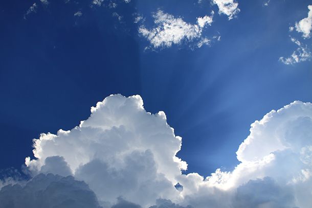
Firstly, we have the formidable cumulonimbus clouds. Known as thunderheads, these towering behemoths are the champions of rainfall production. With their heights often exceeding 18,288 metres (60,000 feet), cumulonimbus clouds can span across all three cloud levels - high, middle, and low. Their signature anvil-shaped tops are a telltale sign. These clouds often bring severe weather conditions, including thunderstorms, heavy rain, lightning, hail, and even tornadoes. Rainfall from these cloud types can be as high as 12 cm (approximately 5 inches) per hour. When you spot a cumulonimbus cloud, it's a signal to find shelter as a substantial downpour is on its way.
Nimbostratus Clouds
Coming in next are the nimbostratus clouds. These low-level, broad, and dark clouds blanket the sky, casting a shadow of gloom. They are typically associated with steady, continuous rainfall or snowfall. Unlike the abrupt, heavy downpour associated with cumulonimbus clouds, nimbostratus clouds bring about extended periods of precipitation that can last for several hours or even days. These clouds can produce rainfall of around 1 cm (0.4 inches) per hour. These are the type of clouds that result in those grey, overcast days where it seems the rain is relentless.
Stratocumulus Clouds
Next are the stratocumulus clouds. These low-level, lumpy, grey clouds often span the entire sky. While stratocumulus clouds can produce light precipitation, it's not a continuous downpour like with nimbostratus clouds. Instead, the rain from stratocumulus clouds is generally light and intermittent, often appearing as a drizzle. Rainfall from stratocumulus clouds usually does not exceed 0.5 cm (0.2 inches) per hour.
Altostratus Clouds
Altostratus clouds are mid-level, grey or blue-grey clouds that usually cover the entire sky. They often precede a storm system, bringing continuous, light to moderate rain or snow. Although they are not usually linked with heavy precipitation, altostratus clouds can bring a fair amount of rainfall, especially if they persist for a prolonged period. They typically generate rainfall of about 0.3 cm (0.1 inches) per hour.
Stratus Clouds
Completing our list are stratus clouds. These low-level, uniform, grey clouds often cover the entire sky, resembling a fog that doesn't touch the ground. While stratus clouds can produce drizzle or light rain or snow, they are generally associated with overcast skies and dull weather rather than significant precipitation. The rainfall from stratus clouds is usually less than 0.2 cm (0.1 inches) per hour.
Hail Producers: Ranking Cloud Types by Hailstone Magnitude
Introduction: Hail, those icy projectiles falling from the sky, is an intriguing, yet potentially damaging weather phenomenon. Hailstones, born from turbulent thunderstorms, can range from small pellets to destructive balls of ice measuring several centimetres in diameter. But which types of clouds are the real culprits when it comes to hail formation? In this blog, we'll delve into the atmospheric mechanics of hail production and rank the cloud types in order of their potential to produce hail, from the heaviest to the lightest.
Cumulonimbus Clouds
Topping our list are the cumulonimbus clouds. These towering, anvil-shaped clouds are the primary hail producers, capable of forming hailstones that reach up to 15 centimetres in diameter - roughly the size of a grapefruit! Cumulonimbus clouds can reach up to 18 kilometres high into the troposphere, where temperatures are well below freezing. Inside these clouds, updrafts and downdrafts cause water droplets to ascend and descend repeatedly, gathering layers of ice until they become too heavy to be supported by the updraft and fall as hail. These are the clouds to watch out for when severe thunderstorms, and thus significant hail, is forecasted.
Nimbostratus Clouds
Next on our list are nimbostratus clouds. They are generally associated with continuous precipitation and can produce hail, but the hailstones are usually smaller in size, often around 1 centimetre in diameter. Nimbostratus clouds lack the intense updrafts found in cumulonimbus clouds, which means that hailstones don't usually undergo as many freezing layers, resulting in smaller hailstones.
Cumulus Congestus Clouds
Cumulus congestus, or towering cumulus, clouds can also produce hail. These clouds are the precursor to cumulonimbus clouds, signifying significant atmospheric instability. While they can generate hail, the stones are generally smaller, usually under 1 centimetre in diameter, as these clouds lack the height and internal structure needed for substantial hail formation.
Conclusion: While several types of clouds can produce hail, the size and severity of the hailstones largely depend on the cloud's structure and the atmospheric conditions. The towering cumulonimbus reigns supreme in its ability to produce the most substantial hail, due to its size, height, and internal dynamics. Nimbostratus and cumulus congestus clouds can also generate hail, but it tends to be smaller.
Understanding the relationship between cloud types and hail formation can help us better predict and prepare for severe weather events. So next time you look up and see those towering cumulonimbus clouds, remember the powerful natural processes at work and consider seeking shelter, just in case those icy stones start to fall!
The Clouds That Make Our Winters White: Snow-Producing Clouds Explained
The type of precipitation that falls, including snow, is heavily influenced by the temperature profile of the atmosphere, rather than by the specific type of cloud. That said, some types of clouds are more commonly associated with snowfall than others.
Please note that a single type of cloud doesn't necessarily produce snow by itself. It's more about the system these clouds are part of, the temperature profile, and how saturated with water vapour the atmosphere is. Here are some cloud types which are typically associated with snowfall:
Nimbostratus
These clouds are the stereotypical snow-producing clouds. They are thick and grey, often extending over a large portion of the sky. Nimbostratus clouds typically bring steady, light to moderate snowfall.
Stratocumulus
While more often associated with light rain, these low-lying, lumpy clouds can also produce light snow, especially if the temperatures are below freezing at ground level.
Altostratus and Altocumulus
These mid-level clouds can sometimes be associated with snow, particularly if they are part of an approaching warm front in the winter.
Cumulonimbus
Though they're more commonly associated with thunderstorms and heavy rain, in the right conditions, these clouds can produce snow or even thundersnow. However, this is less common than snow from nimbostratus clouds.
Stratus
These are low-level, uniform, grey clouds that often cover the entire sky. They can produce drizzle, and in cold conditions, this could turn into light snow or freezing drizzle.
Remember, snow production is not solely a function of the cloud type but also depends on other meteorological conditions. For example, snow requires temperatures below the freezing point from the cloud level to the ground. In addition, the cloud must contain enough moisture, and atmospheric pressure also plays a role.
Clouds are a fascinating piece of our planet's atmospheric puzzle
As we pull the curtains on our exploration of cloud types and their precipitation patterns, it's important to remember that the sky's spectacle offers more than just visual wonder. Clouds are a fascinating piece of our planet's atmospheric puzzle, acting as crucial agents in the Earth's water cycle. From the formidable cumulonimbus clouds that bring us thunderstorms to the low-lying stratus clouds that might sprinkle light snow on a cold day, each cloud type has its unique role and character.
Remember, snowfall isn't strictly a product of specific cloud types, but a culmination of various meteorological factors, such as temperature profiles, atmospheric moisture, and pressure. Though some cloud types are more frequently associated with snow, it's the interplay of these elements that ultimately determines whether we'll be greeted with a snow-kissed landscape.
The next time you gaze at the sky and see these celestial formations, take a moment to appreciate the complex and intricate processes at work that result in diverse weather phenomena. After all, understanding the secrets of the sky can deepen our connection with nature, enhance our weather predictions, and add a touch of magic to our everyday observations.
I do hope you have enjoyed this article and hope that you will subscribe to my newsletter so you can get the latest information about all things naturally relaxing.
Stay in touch, join the Naturally Relaxing Newsletter
Newsletter Signup
Post Your Comments
or post as a guest
Be the first to comment.
Latest articles in Weather

Winter Getaways: Escape the Chill with These Enchanting Winter Destinations

Embrace Autumn's Coziness: Finding Comfort in the Magic of the Season

Understanding Seasons: Discover the Symbolic Meanings of the Four Seasons

Embracing Autumn: Your Ultimate Guide to Seasonal Preparation and Trends

Essential Tips for Staying Cool and Safe During a Scorching Heat Wave


